Multiple Western Disturbances Likely to Affect J&K From Jan 17; Major System Expected Jan 22–26Meteorological indications suggest that several small Western Disturbances could affect North India, including Jammu and Kashmir, between January 17 and January 22. These systems may bring intermittent spells of rain and snowfall, particularly in higher reaches of the Union Territory. Forecasters further indicate that a strong Western Disturbance is likely to impact the region between January 22 and January 26. If the system materialises as projected, it could result in widespread snowfall in upper areas and rain or snow in lower elevations, potentially affecting road connectivity, power supply, and daily life in parts of J&K. However, weather experts caution that these projections are based on model forecasts and are subject to change as systems evolve closer to the actual dates. Authorities and residents have been advised to stay updated with official weather bulletins in the coming days.

Fresh snowfall, rains bring sharp dip in Kashmir temperature

The Meteorological Department has forecast continued wet weather for the next 24 hours in the valley.

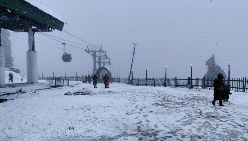
Srinagar, Oct 6: Fresh snowfall in the higher reaches and showers in the plains of Kashmir on Monday led to a sharp drop in day temperatures in the valley, officials said.

Snowfall was reported from Sinthan Top in Anantnag district, Affarwat in Gulmarg, Zojila Pass, Bangus in Kupwara, Razdan Pass in Gurez valley and other higher-altitude areas, they said.

Light to moderate rainfall was witnessed in the plains of Kashmir, including Srinagar city, they added.

The day temperature in the valley dipped by nearly 10 degrees, with the city recording a maximum of around 11 degrees Celsius on Monday, compared to 22.6 degrees Celsius recorded a day earlier.

The Meteorological Department has forecast continued wet weather for the next 24 hours in the valley.

Total
0
Shares
Leave a Reply

Your email address will not be published. Required fields are marked *

Related Posts